


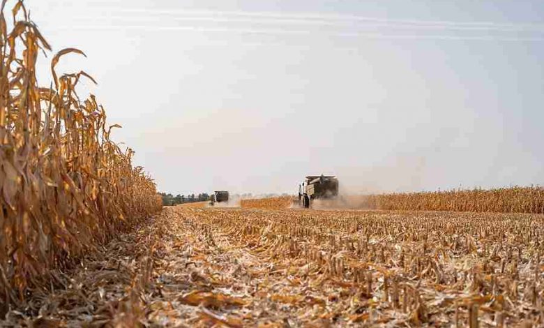
Another dry and warmer than normal week statewide led to 6.8 days suitable for fieldwork during the week ending November 19, 2023, according to the USDA, National Agricultural Statistics Service. Fieldwork included harvesting corn, completing fall tillage, applying fall fertilizer, and hauling manure. Reports of tile work being done in fields were received this week.
Topsoil moisture condition rated 22% very short, 47% short, 31% adequate and 0%
surplus. Subsoil moisture condition rated 32% very short, 43% short, 24% adequate and 1% surplus.
Corn harvested for grain reached 97% statewide, on pace with last year but 10 days ahead of the 5-year average. Farmers in South Central Iowa still have over 10% of their corn for grain crop remaining to be harvested.
Cattle continued grazing on stalk fields. Reports of more calves being weaned were received.
IOWA PRELIMINARY WEATHER SUMMARY
Provided by Justin Glisan, Ph.D., State Climatologist
Iowa Department of Agriculture and Land Stewardship
A warm and dry weather pattern persisted across Iowa for a second consecutive reporting period as temperatures were up to 12 degrees above normal; the statewide average temperature was 45.5 degrees, 8.2 degrees above normal. Preliminary rain gauge data indicates only five stations reported more than a trace of rainfall with 10 days remaining in a particularly dry November.
Gusty southerly winds gradually shifted to the west into Sunday (12th) afternoon under sunny skies and high temperatures in the mid to upper 60s. Clear conditions continued overnight as winds became light and lows dropped into the upper 20s northwest to mid-30s southeast. Spotty clouds were reported across southern Iowa on Monday (13th) with daytime highs in the upper 50s and low 60s. Southerly winds increased overnight into Tuesday (14th) with morning lows varying from the low 30s in eastern Iowa to mid-40s west. Winds increased through the afternoon hours as a low-pressure center pushed across the Upper Midwest. Low 70s were observed at several stations in western Iowa with 60s across the rest of the state. Cloud cover increased into the early hours of Wednesday (15th) as a quick-moving cold front moved through Iowa. There was a wide range of lows reported at 7:00 am with low 40s southeast to the mid-20s northwest. Daytime conditions were similar to the previous day though hazy skies were observed in southern Iowa. Light showers formed in western Iowa along a weak cold front after sunset and continued into eastern Iowa after midnight on Thursday (16th). Seven stations across northern and eastern Iowa reported a trace of rainfall with 0.02 inches at Oelwein Municipal Airport (Fayette County) and 0.04 inches in Lee County. Winds shifted to the northwest and then more westerly as the day progressed; high temperatures rose into the mid to upper 40s behind the fast surface boundary. Saturday (18th) began generally cloudless with morning lows in the 20s and light winds; afternoon conditions were sunny as temperatures jumped into the low 60s west to upper 50s east. Winds became light and easterly into Sunday (19th) morning with low to mid 30s statewide.
Weekly precipitation totals ranged from no accumulation at most of Iowa’s stations to 0.04 inches at Keokuk Municipal Airport (Lee County). The statewide weekly average precipitation was 0.00 inch, while the normal is 0.43 inches. Little Sioux (Harrison County) reported the week’s high temperature of 71 degrees on the 15th, 23 degrees above normal. Mapleton (Monona County) reported the week’s low temperature of 17 degrees on the 18th, six degrees below normal.