


A dry and hot week allowed Iowa farmers 6.2 days suitable for fieldwork during the week ending July 30th according to the USDA, National Agricultural Statistics Service. Field activities included cutting hay and harvesting oats. More reports were received of farmers applying fungicides. The continued dry conditions made crop stress more widespread.
Topsoil moisture condition rated 19% very short, 42% short, 38% adequate and 1% surplus. Subsoil moisture condition rated 20% very short, 47% short, 32% adequate and 1% surplus.
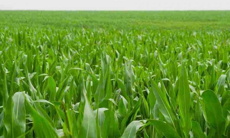
Corn silking hit 92% this week, 1 week ahead of last year and 5 days ahead of normal. Thirty-seven percent of the corn crop has reached the dough stage or beyond, 3 days ahead of both last year and the 5-year average. Five percent of the corn crop has reached the dent stage, 8 days ahead of last year and 6 days ahead of normal. Corn condition dropped to 59% good to excellent.
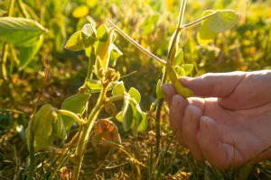 Ninety-three percent of soybeans were blooming, nearly 2 weeks ahead of last year and 11 days ahead of the average. Soybeans setting pods reached 57%, 3 days ahead of last year and 2 days ahead of the 5-year average. Soybean condition fell to 55% good to excellent. Ninety-eight percent of oats were turning color with 55% harvested for grain, a day behind both last year and the five-year average.
Oat condition rated 55% good to excellent.
The State’s second cutting of alfalfa hay reached 93% complete, 6 days ahead of both last year and the average. The State’s third cutting of alfalfa hay reached 33% complete, 11 days ahead of last year and 10 days ahead of the 5-year average. Hay condition rated 36% good to excellent. Pasture condition rated 23% good to excellent. Some livestock producers have been hauling water and feeding hay to their cattle in the continued dry conditions. Intense heat this week brought a lot of stress to livestock with some feedlots experiencing death loss.
 IOWA PRELIMINARY WEATHER SUMMARY
Provided by Justin Glisan, Ph.D., State Climatologist
Iowa Department of Agriculture and Land Stewardship
Reports from the Iowa Department of Agriculture and Land Stewardship and maps from the Midwestern Regional Climate Center reflect data collected from 7:00 A.M. Central Time on July 24, 2023, through 7:00 A.M. Central Time on July 30, 2023.
A large-scale ridge that brought oppressive heat across the south over the last weeks lifted into the Midwest early in the reporting period. Iowans experienced several days of unseasonably hot temperatures and a stifling triple-digit heat index; the statewide average temperature was 77.9 degrees, 4.8 degrees above normal. Rain fell over several days with strong to severe thunderstorms towards the weekend. Overall, it was an unseasonably dry week with stations reporting negative departures above 0.50 inches.
Sunday (23rd) afternoon temperatures ranged from the upper 70s north to upper 80s south under generally clear skies with light northerly winds. Clouds increased over southwestern Iowa overnight into Monday (24th) as a complex of strong thunderstorms, some severe-warned, moved southeast over the Iowa-Nebraska border. More of the intense thunderstorms produced heavier rainfall ranging from 0.40 inches in Logan (Harrison County) to 0.85 inches in Oakland (Pottawattamie County). Sunny skies prevailed statewide with daytime highs pushing into the upper 80s as winds swung to the south. Foggy conditions were reported through the early morning hours on Tuesday (25th) with morning lows in the mid-60s. Light showers pushed across southern Iowa through the day with temperatures in the low 80s under cloud cover. Rain totals were widespread, though under a tenth of an inch at most stations. An isolated severe thunderstorm sped across northwestern Iowa early on Wednesday (26th) producing golf-ball-sized hail from Sutherland (O’Brien County) to Fonda (Pocahontas County); Primghar (O’Brien County) and Sioux Rapids
(Buena Vista County) measured 0.46 inches of rainfall from the cell. Scattered thunderstorms also fired in northeastern Iowa after sunrise with several stations in Winneshiek County observing totals between 0.33 to 0.35 inches. Skies continued to clear through the afternoon hours with light northerly winds and daytime temperatures in the upper 80s and low 90s.
Overnight lows on Thursday (27th) bottomed out in the upper 60s and low 70s as an eastward-moving boundary produced showers and a few thunderstorms over Iowa’s southern two-thirds. A small swath of west-central Iowa picked up totals in the 0.50 to 1.00- inch range with Sac City (Sac County) measuring 0.63 inches while Jefferson (Greene County) reported 1.03 inches. Highs were in the mid-90s in southeastern Iowa, though up to 10 degrees cooler in central Iowa from rain-cooled air and clouds. Overnight lows into Friday (28th) were unseasonably warm with a statewide average low of 71 degrees, nine degrees above normal. Under sunny skies, southwesterly winds and high dewpoints, temperatures rose into the mid to upper 90s at many stations as the average high registered at 94 degrees, 11 degrees above normal. Severe storms fired rapidly in north-central Iowa through the evening hours and transitioned to eastern Iowa. There were two weak tornadoes observed in Franklin and Jackson counties along with a wide swath of straight-line wind reports; numerous 90-95 mph gusts were registered around Cedar Rapids (Linn County). Of the stations reporting rainfall, most received at least 0.40 inches with 1.20 inches at Steamboat Rock (Hardin County) and 1.88 inches in Dubuque (Dubuque County). Saturday (29th) was a pleasant and quiet weather day with clear skies, northerly winds and highs in the low 80s. Spotty cloud cover developed into Sunday (30th) with lows in the upper 50s and low 60s.
Weekly precipitation totals ranged from no accumulation in west-central and north-central Iowa to 2.67 inches at Dubuque Regional Airport (Dubuque County). The statewide weekly average precipitation was 0.40es inch while the normal is 0.95 inches.
Keokuk Lock and Dam (Lee County) reported the week’s high temperature of 101 degrees on the 28th, 16 degrees above normal. Forest City reported the week’s low temperature of 51 degrees on the 24th, 11 degrees below normal.
 KIOW Area Weather Summary:
The Forest City area hit two record highs this past week. The first came on the 26th and the second was on the 28th. Both dates set record highs of 90 degrees.
The average high was 80.9 degrees while the normal high is 81.3 degrees leaving the area .4 degrees cooler than normal.
The average low was 57.9 degrees while the normal is 61.5 degrees leaving the area 3.6 degrees cooler than normal.
For the month of July, the area received 2.37 inches of precipitation while the normal amount is 4.6 inches. This leaves the area 2.23 inches below normal for July.