



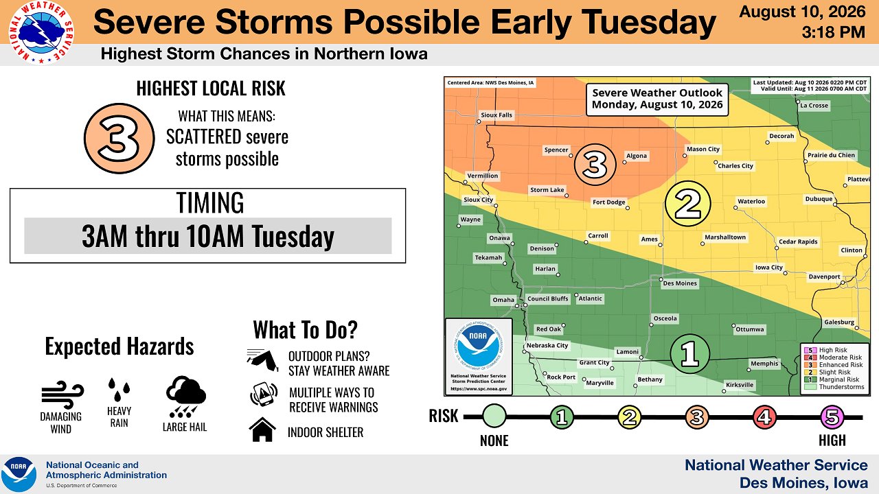
MASON CITY, Iowa — The National Weather Service office in Des Moines has placed north-central Iowa under an Enhanced Risk for severe weather early Tuesday, warning that damaging wind gusts will be the primary threat as a multi-day stretch of unsettled weather sets up across the region.
The Enhanced Risk, a Level 3 of 5 on the weather service’s severity scale, applies to the overnight hours into Tuesday morning, with the main window for storms running from 3 a.m. to 10 a.m., according to a forecast update the agency issued Monday at 3:18 p.m. The update marked an upgrade from earlier forecasts, with the weather service raising northern Iowa into the Enhanced category for Monday night into early Tuesday and adding a hydrologic flooding component to its outlook.
Damaging wind gusts of 60 to 80 mph are expected within the highest-risk area, with gusts of 75 mph or greater possible, especially over northwest Iowa, the weather service said. Isolated large hail up to quarter size and locally heavy rain are also possible, though forecasters said those threats are lower than the wind threat. Tornadoes are considered unlikely Tuesday morning, according to the outlook.
A second round of storms is possible after midnight Tuesday night, with the highest chances shifting toward northeast Iowa, the weather service said. That system carries an isolated severe risk, Level 1 of 5, with damaging wind and heavy rain as the primary hazards.
Forecasters said scattered storm chances will continue into Wednesday, with an isolated severe risk possible Wednesday afternoon into evening bringing damaging wind, hail and heavy rain. Hazy skies and warm, humid conditions are expected to persist through Wednesday, with heat indices approaching 100 degrees in southern and central portions of the state, according to the weather service.
The agency also flagged a multi-day heavy rain and flash flooding threat running from Tuesday through Thursday, with additional rainfall possible into the weekend depending on where earlier storms track. Forecasters said the ground’s sensitivity to heavy rain will increase with each repeated round of storms, raising the potential for local river and stream rises alongside flash flooding.
The weather service urged residents to have multiple ways to receive warnings, particularly overnight, and to move indoors when storms approach.


Stay Connected with Mix 107.3 KIOW
Add Mix 107.3 KIOW as a preferred source on Google to see more local news, weather, and sports in your feed.
Follow us on Facebook for breaking news, severe weather alerts, sports, and more.

