




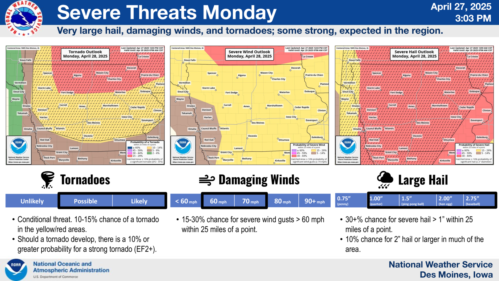
The latest updates from the Storm Prediction Center (SPC) and National Weather Service (NWS) have shifted the Moderate Risk area for severe weather northward, removing central Iowa from the highest risk zone.
However, the threat is far from over. The time frame for severe weather remains from 4 PM until Midnight Monday, and officials urge everyone to take this situation seriously.
If storms do develop in our area, they are expected to form very quickly and move East/Northeast at speeds of more than 50 miles per hour. This rapid movement will drastically reduce warning times, giving residents little time to react.
Any storm that forms could quickly escalate into a significant, high-impact event. There is a real potential for strong tornadoes, rated EF2 or higher, that could be long-tracked. Hail up to 2 inches — or even the size of baseballs — is a major concern, along with the threat of widespread damaging winds.
Stay alert throughout the evening, have multiple ways to receive warnings, and review your safety plans now. Keep it locked to KIOW and B103 for continuous coverage and live updates as conditions change.



Stay Connected with Mix 107.3 KIOW
Add Mix 107.3 KIOW as a preferred source on Google to see more local news, weather, and sports in your feed.
Follow us on Facebook for breaking news, severe weather alerts, sports, and more.

