



⚠️Blizzard Conditions Tonight – Intense Winds & Heavy Snow Expected Across Iowa
Very strong winds combined with snow will make for dangerous travel in the overnight hours tonight into Wednesday.

…BLIZZARD CONDITIONS TONIGHT THROUGH WEDNESDAY WITH INTENSE WINDS AND SNOW…
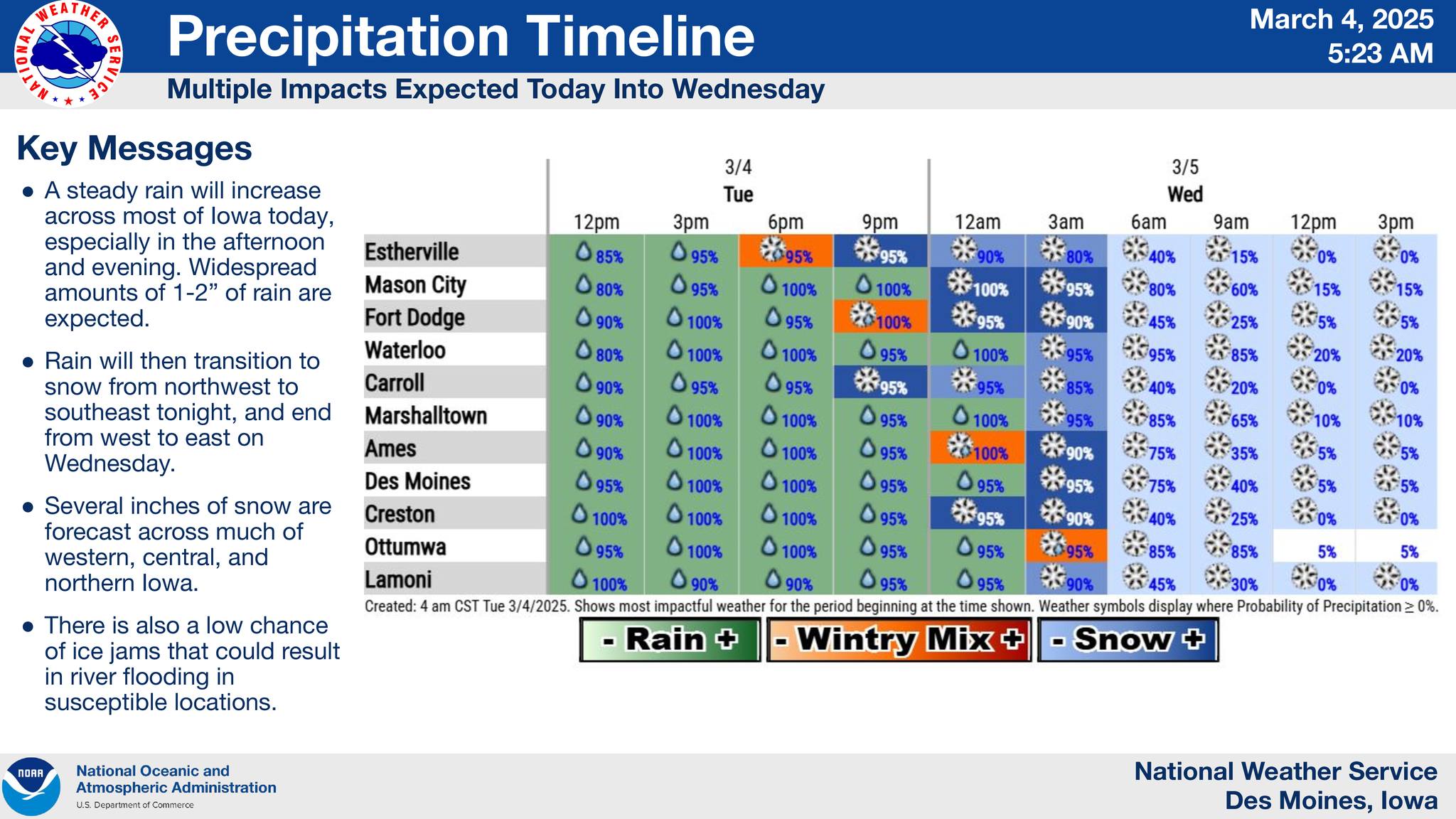
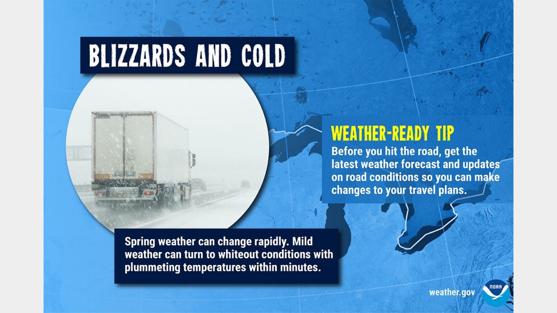
.A strong early spring system is set to affect Iowa later today through tonight into Wednesday. Rain will quickly change to snow from northwest Iowa to southeast Iowa overnight as winds intensify from the northwest and become strong with gusts near or above 60 mph. The combination of these winds with falling snow will cause significant visibility reductions with a period of blizzard conditions expected. Blowing and drifting snow with whiteout conditions, particularly in open, rural areas, will make travel dangerous at times tonight into at least a part of Wednesday morning. Even as the falling snow ends, blowing snow and visibility restrictions may persist. Conditions are expected to gradually improve later Wednesday as the winds slowly decrease.
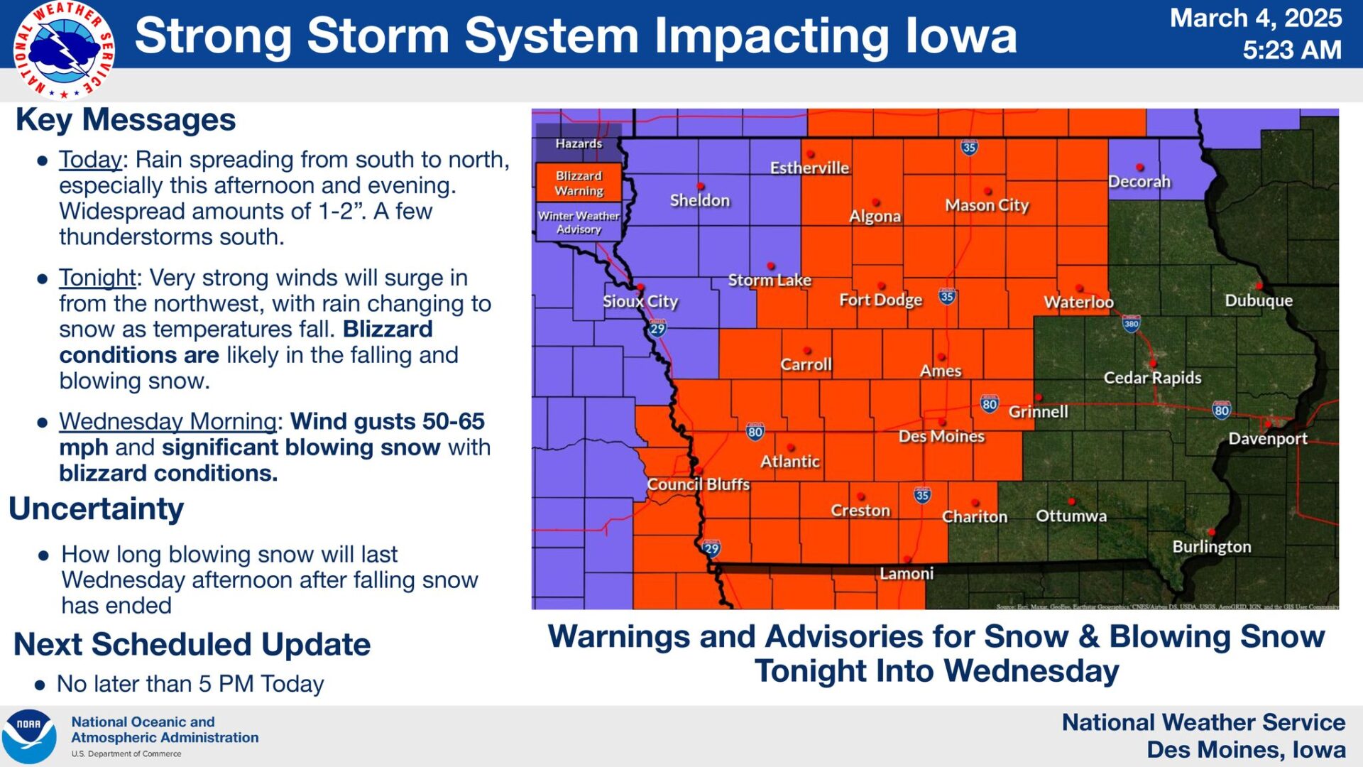
…BLIZZARD WARNING IN EFFECT FROM 9 PM THIS EVENING TO 3 PM CST WEDNESDAY…
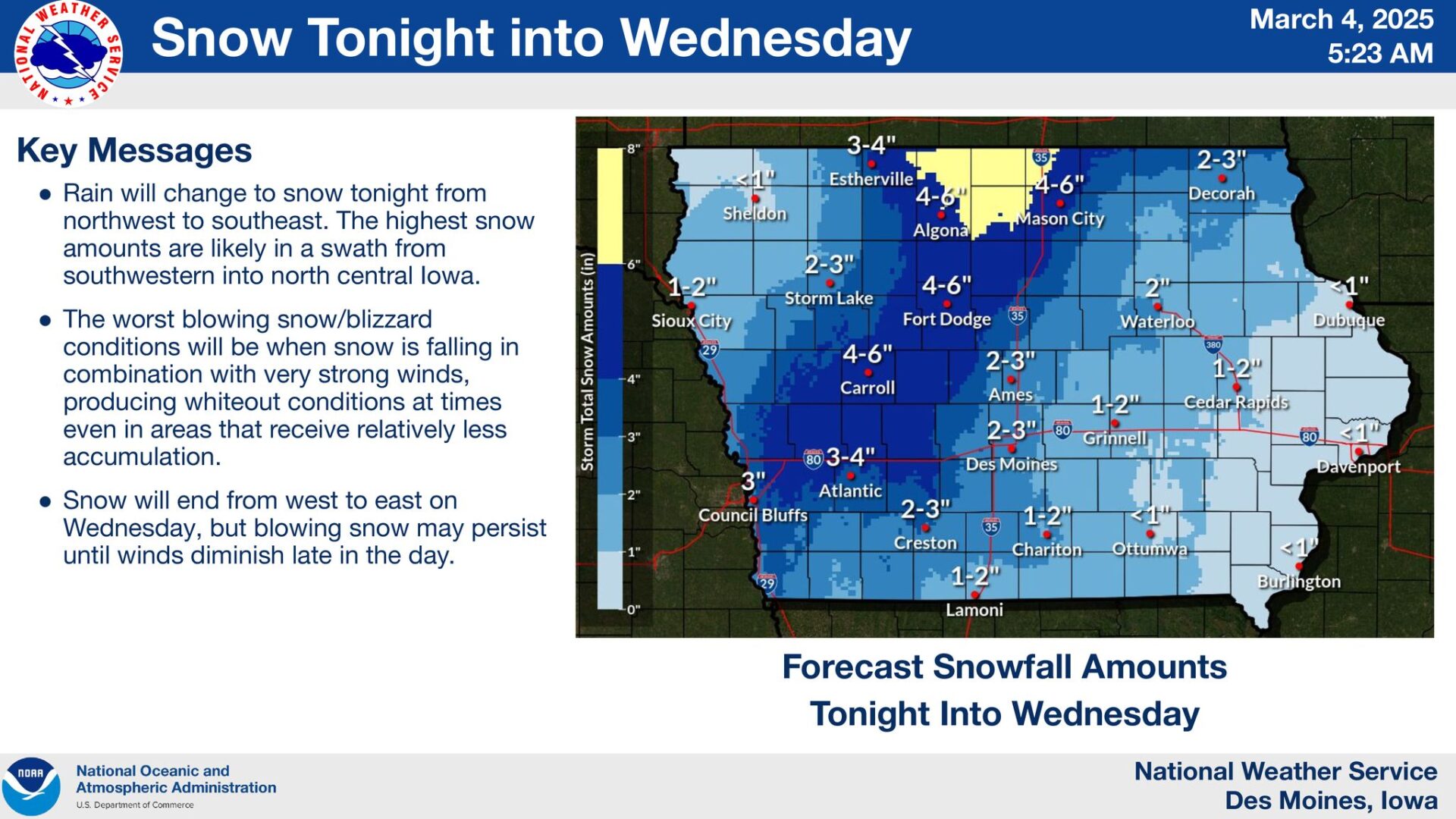
* WHAT…Blizzard conditions expected. Total snow accumulations between 3 and 6 inches with a few higher amounts near the
Minnesota border. Winds gusting as high as 65 mph.
* WHERE…North central into central Iowa.
* WHEN…From 9 PM this evening to 3 PM CST Wednesday.
* IMPACTS…Visibilities may drop below 1/4 mile due to falling and blowing snow. Plan on slippery road conditions. The hazardous
conditions are likely to impact the Wednesday morning commute. Strong winds could cause tree damage.
PRECAUTIONARY/PREPAREDNESS ACTIONS…
Travel should be restricted to emergencies only. If you must travel, have a winter survival kit with you. If you get stranded, stay with
your vehicle.
For the latest travel conditions, check the Iowa 511 app, www.511ia.org, or dial 511.
Persons should delay all travel if possible. If travel is absolutely necessary, drive with extreme caution and be prepared for sudden
changes in visibility. Leave plenty of room between you and the motorist ahead of you, and allow extra time to reach your
destination. Avoid sudden braking or acceleration, and be especially cautious on hills or when making turns. Make sure your car is
winterized and in good working order.
…HIGH WIND WARNING IN EFFECT FROM 9 PM THIS EVENING TO 3 PM CST WEDNESDAY…
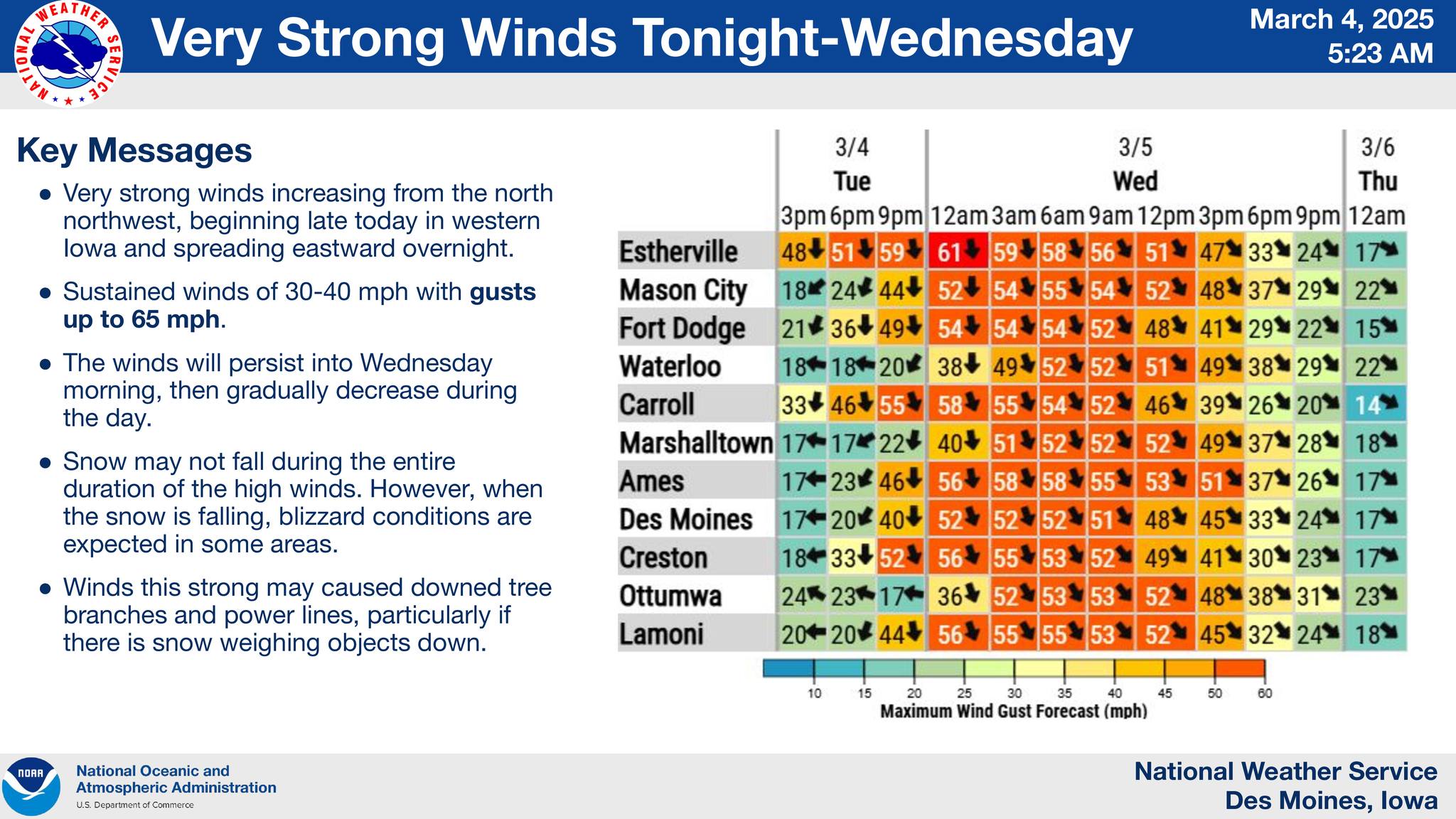
* WHAT…North winds 30 to 40 mph with gusts up to 65 mph expected.
* WHERE…Central Iowa.
* WHEN…From 9 PM this evening to 3 PM CST Wednesday.
* IMPACTS…Damaging winds will blow down trees and power lines. Widespread power outages are expected. Travel will be difficult,
especially for high profile vehicles.
* ADDITIONAL DETAILS…In addition, there is also a Blizzard Warning in effect.
PRECAUTIONARY/PREPAREDNESS ACTIONS…
Remain in the lower levels of your home during the windstorm, and avoid windows. Watch for falling debris and tree limbs. Use caution
if you must drive.
Stay Connected with Mix 107.3 KIOW
Add Mix 107.3 KIOW as a preferred source on Google to see more local news, weather, and sports in your feed.
Follow us on Facebook for breaking news, severe weather alerts, sports, and more.
